RICHARD NICHOLSON of CHESTER
A WORLD OF ANTIQUE MAPS AND PRINTS
The Cartographer
EMANUEL BOWEN
1694 - 1767
Some of Bowen's county maps are easily recognised by the panels of text filling every available space
EMANUEL BOWEN AND THOMAS KITCHIN
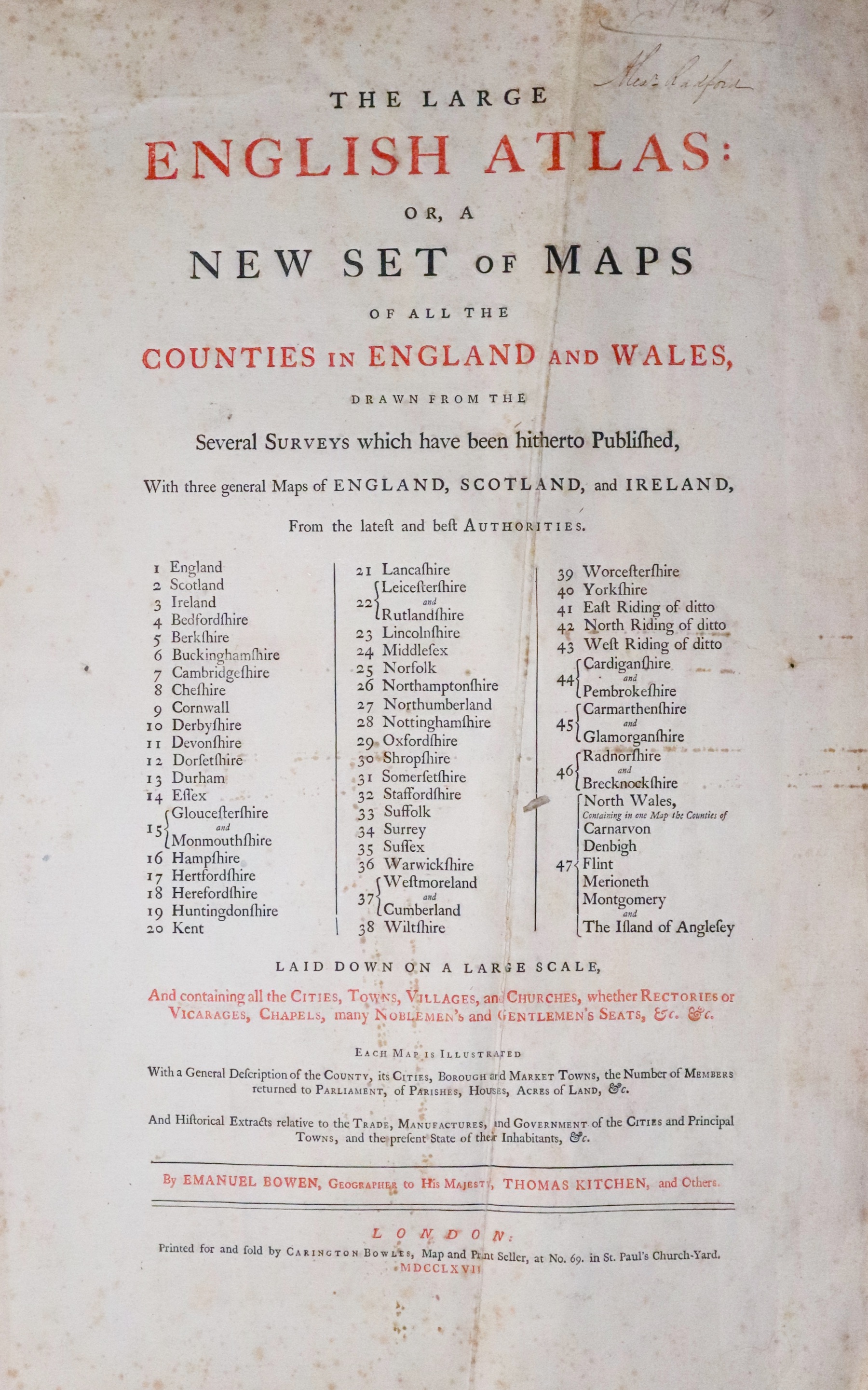
The Large English Atlas or, A New Set of Maps of all the Counties in England and Wales
There were a number of editions of The Large English Atlas from 1755 to about 1787. I have found that the contents of the copies of the atlas I have handled over the years do vary. This list I have constructed below is take from a copy of the atlas in my own collection which has an added undated titlepage but which I am guessing is the 1787 edition. The usual way to date these maps is from the publishers imprint beneath each map. The early editions have the names of J. Tinney, T. Bowles, J. Bowles and Robert Sayer. Later editions have the names of Robert Wilkinson, Robert Sayer and Carington Bowles.
-
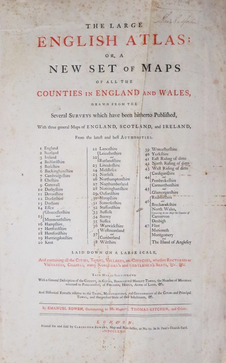
Large English Atlas by Emanuel Bowen Titlepage 1767
LIST OF MAPS IN MY ATLAS
- An Accurate Map of England and Wales...By Thoms Kitchin
- An Accurate Map of the County of Bedford...By Emanuel Bowen
- An Accutae Map of Berkshire...By Emanuel Bowen
- An Accurate Map of Buckinghamshire...By Emanuel Bowen
- An Accurate Map of Cambridgeshire...By Emanuel Bowen
- An Accurate Map of the County Palatine of Chester...By Emanuel Bowen
- A New Improved Map of Cornwall...By Thomas Kitchin
- An Accurate Map of the County of Derby...By Emanuel Bowen
- An Accurate Map of Devon Shire...By Emanuel Bowen
- An Accurate Map of Dorsetshire...By Emanuel Bowen
- An Accurate Map of the County Palatine of Durham...By Thomas Kitchin
- An Accurate Map of the County of Essex...By Emanuel Bowen
- An Accurate Map of the Counties of Gloucester and Monmouth
- A New and Improved Map of Hampshire...By Thomas Kitchin
- A New Improved Map of Hartfordshire...By Thomas Kitchin
- An Accurate Map of Herefordshire...By Emanuel Bowen
- An Accurate Map of the County of Huntingdon...By Emanuel Bowen
- An Accurate Map of the County of Kent...By Emanuel Bowen
- An Accurate Map of the County of Lancaster...BY Emanuel Bowen
- An Accurate Map of the Counties of Leicester and Rutland...By Emanuel Bowen
- An Accurate Map of Lincolnshire divided into Wapontakes...By Emanuel Bowen
- To the Most Noble Thomas Pelham Diuke of Newcastle This Map of the County of Middlesex is dedicated...R. W.Seale
- An Accurate Map of the County of Norfolk...By Emanuel Bowen
- An Accurate Map of Northamptonshire Divided into its Hundreds...By Emanuel Bowen
- A New Improved Map of Northumberland...By Thomas Kitchin
- An Accurate Map of Nottinghamshire...By Emanuel Bowen
- A New Improved Map of Oxfordshire...By Thomas Kitchin
- An Improved Map of the County of Somerset Divided into its Hundreds...By Emanuel Bowen
- An Improved Map of the County of Stafford Divided into its Hundreds...By Emanuel Bowen
- An Accurate Map of the County of Suffolk Divided into its Hundreds...By Emanuel Bowen
- An Accurate Map of the County of Surrey Divided into its Hundreds...By Emanuel Bowen
- An Accurate Map of the County of Sussex...By Emanuel Bowen
- An Accurate Map of the County of Warwickshire...By Thomas Jefferys
- A New Map of the Counties Cumberland and Westmoreland...
- An Improved Map of Wiltshire Divided into its HundredsBy Emanuel Bowen
- An Accurate Map of the County of Worcester Divided into its Hundreds...By Emanuel Bowen
- An Accurate Map of the County of York Divided into its Ridings...By Emanuel Bowen
- An Accurate Map of the East Riding of York Shire...By Emanuel Bowen
- An Accurate Map of the North Riding of York Shire...By Emanuel Bowen
- An Accurate Map of the West Riding of York Shire...By Emanuel Bowen
- An Accurate Map of Cardigan Shire...By Thomas Kitchin
- An Accurate Map of Pembroke Shire...By Thomas Kitchin
- An Accurate Map of Carmarthenshire...By Thomas Kitchin
- An Accurate Map of Glarmorganshire,,,By Thomas Kitchin
- An Accurate Map of Radnorshire...By Thomas Kitchin
- An Accurate Map of Brecknock Shire...By Thomas Kitchin
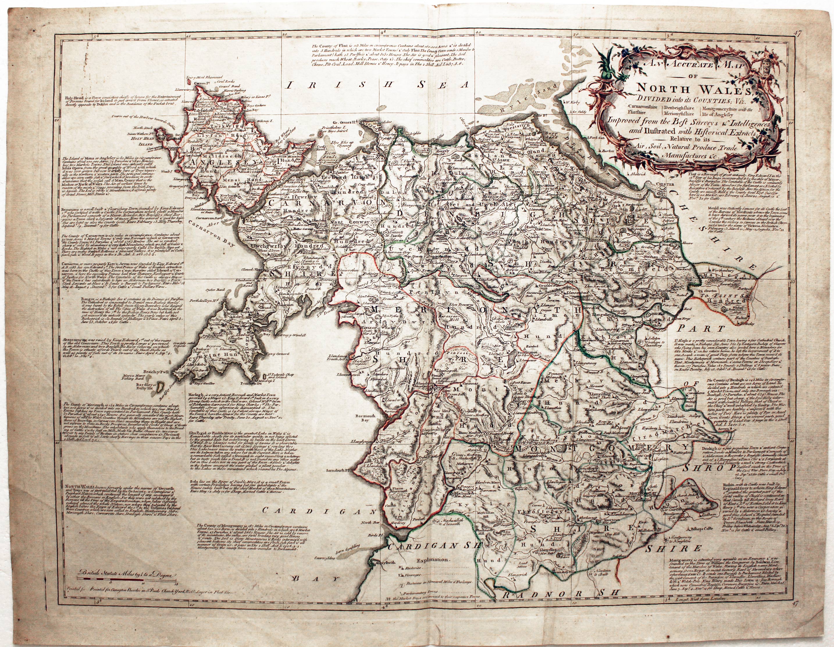
- An Accurate Map of North Wales
All of the Welsh county maps are half page in size and abut each other. So when you find a loose map it will either be with its county partner on the same printed sheet or it will be a single county with no blank margin on one side or with an added margin on one side.
Gallery
-
North Wales by Emanuel Bowen
EMANUEL BOWEN AND THOMAS KITCHIN
THE ROYAL ENGLISH ATLAS : BEING A NEW AND ACCURATE SET OF MAPS OF ALL THE COUNTIES OF SOUTH BRITAIN.....
LIST OF MAPS IN THE ATLAS
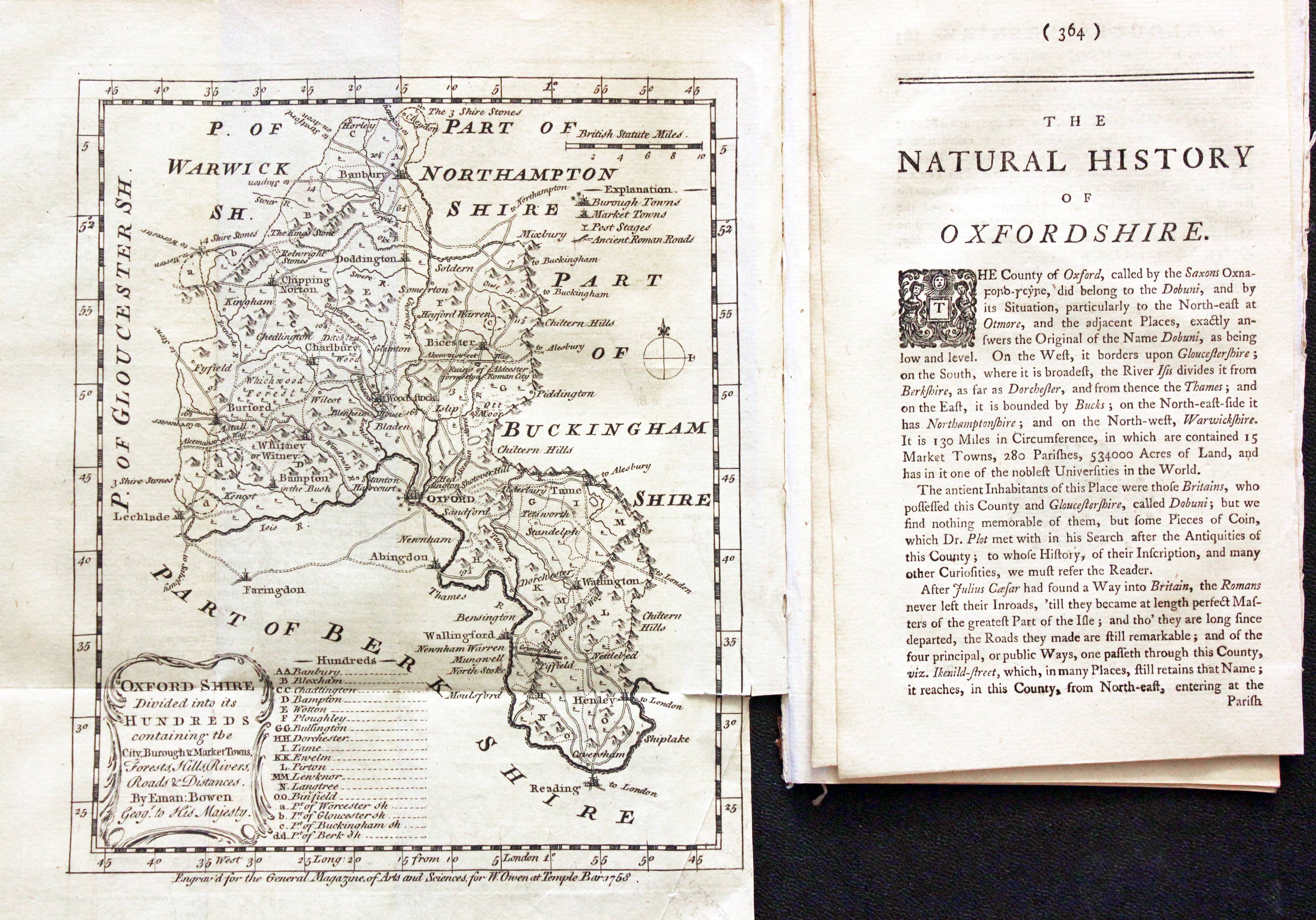
Natural History of England
-

Oxfordshire by Emanuel Bowen
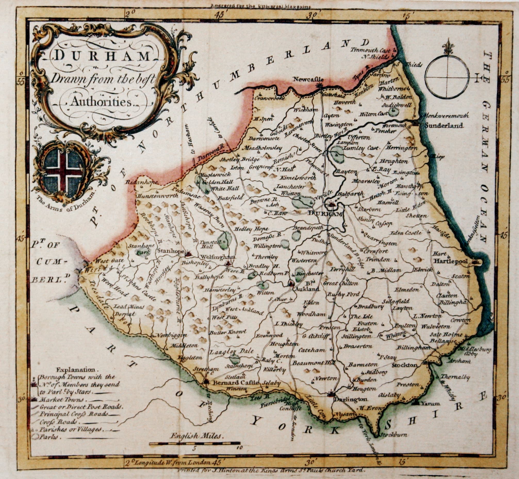
The Universal Magazine
-

Co.unty Durham by Emanuel Bowen c.1755
-
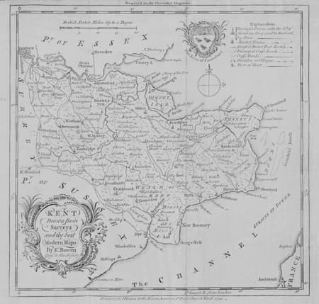
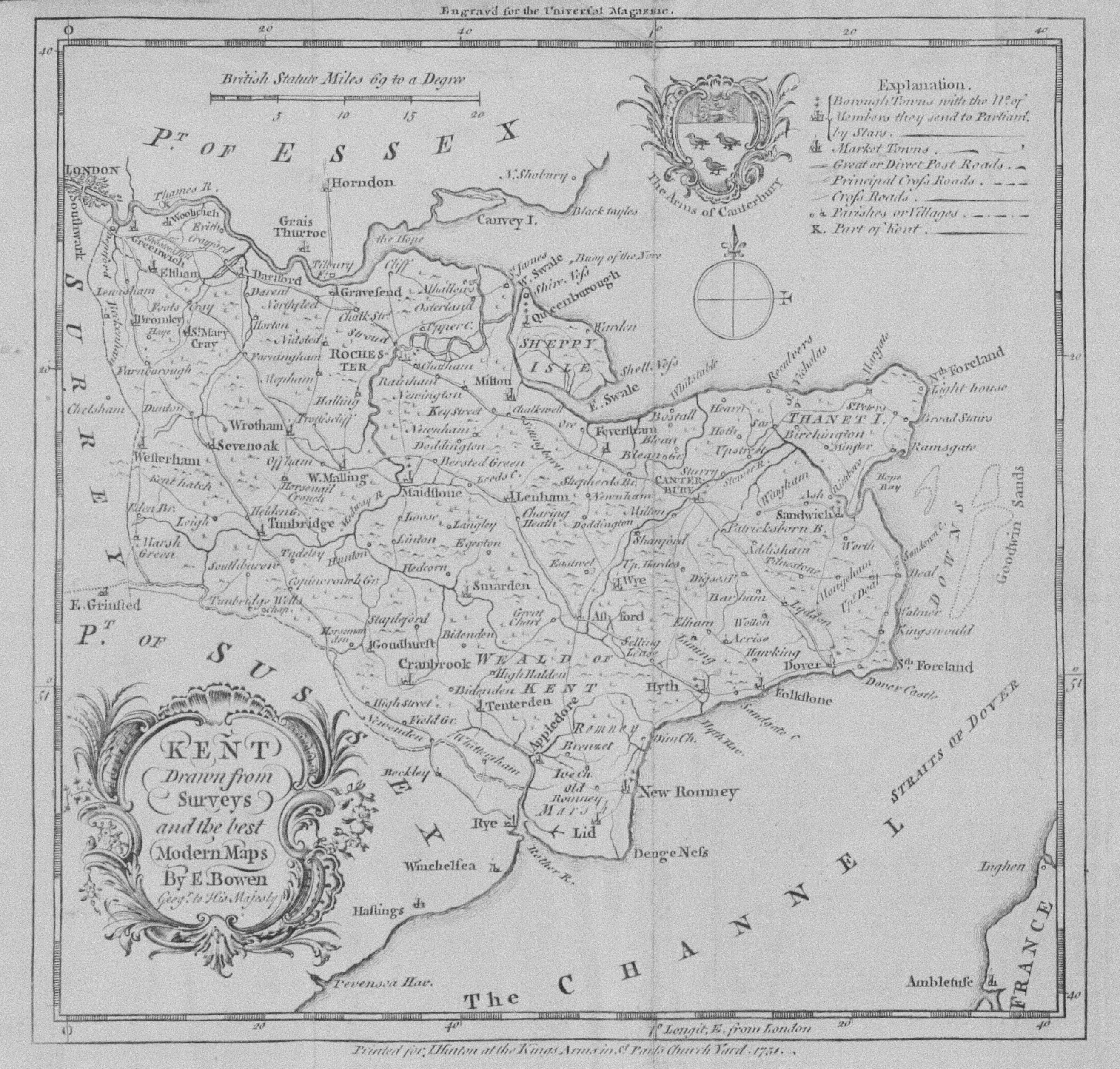
Kent by Emanuel Bowen c.1749
-

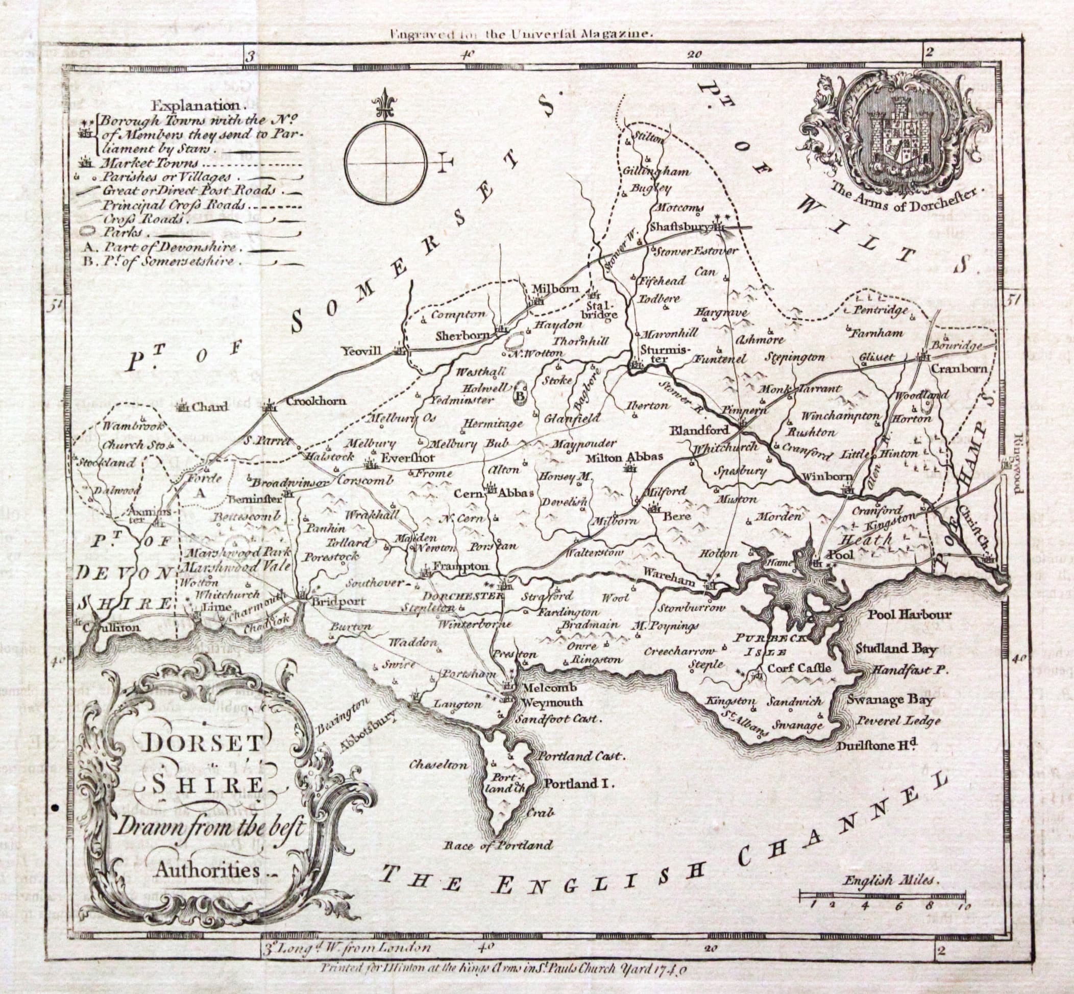
Dorsetshire by Emanuel Bowen c.1749
