Web Analytics Made Easy -
StatCounter

Road Maps of London

RICHARD NICHOLSON of CHESTER

A World of Antique Maps and Prints

James Pepper reading

Established in 1961

All the Maps on this page are guaranteed to be genuine early specimens
published in or around the year stated

English and Welsh Counties Menu

Cary's Survey of the High Roads from London

1801

James Pepper pointing

On a Scale of one Inch to a Mile

Every Gentleman's Seat, situate on, or seen from the Road, (however distant) are laid down, with the Name of the Possessor; to which is added The Number of INNS on each separate Route Also The different TURKPIKE GATES, showing The Connection which one Trust has with another. Published in London in 1801 The following road maps each measure about 5 x 7 1/2 inches. Original early hand colouring. A little soiling as noted but generally in the condition that one normally finds these maps in.

Some routes extend to two maps hence the use of the words PART or COMPLETE in the descriptions.

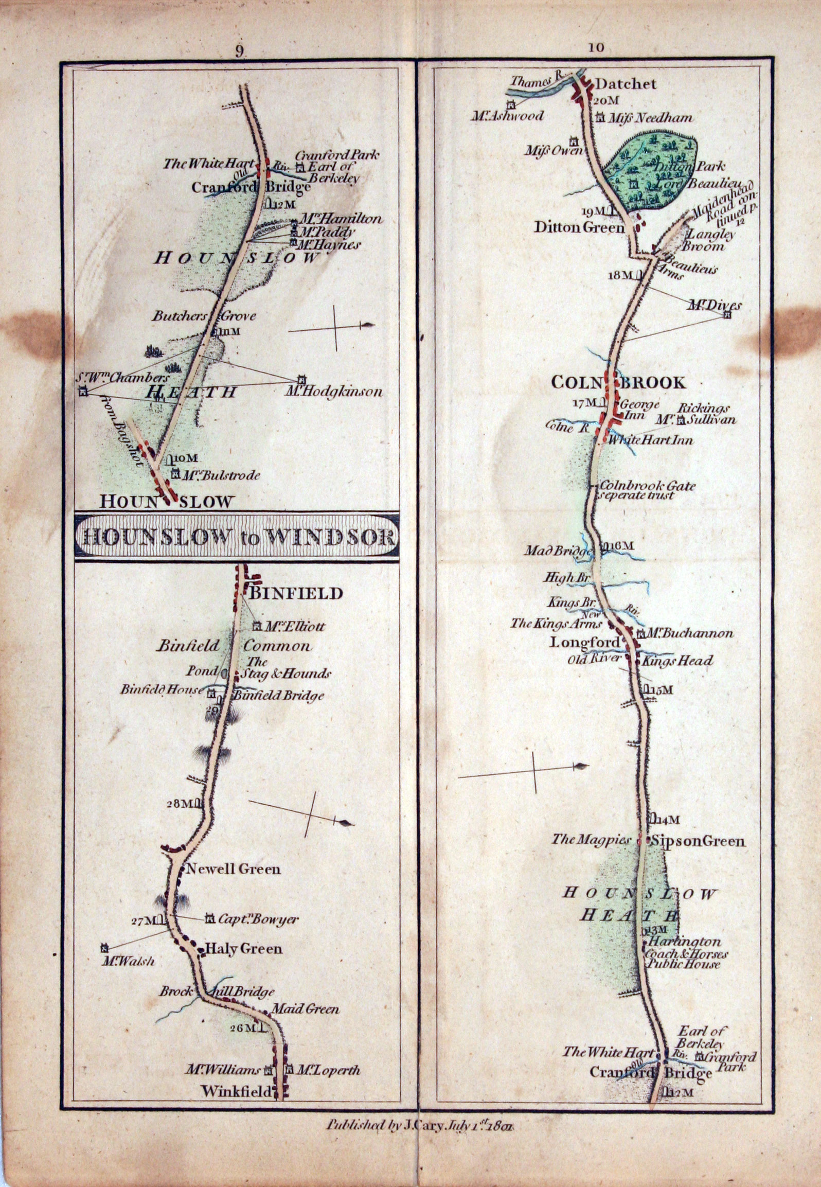
Plate 9/10

  • Egham to Binfield, Cary Road Map 1801

    Egham to Binfield, Cary Road Map 1801

Ref: 14105

9/10 EGHAM TO BINFIELD - Part. Winkfield, Binfield. HOUNSLOW TO WINDSOR - Part. Hounslow, Cranford Bridge, Colnbrook, Datchet.

Two small brown stains and light soiling.

Price: 33.00

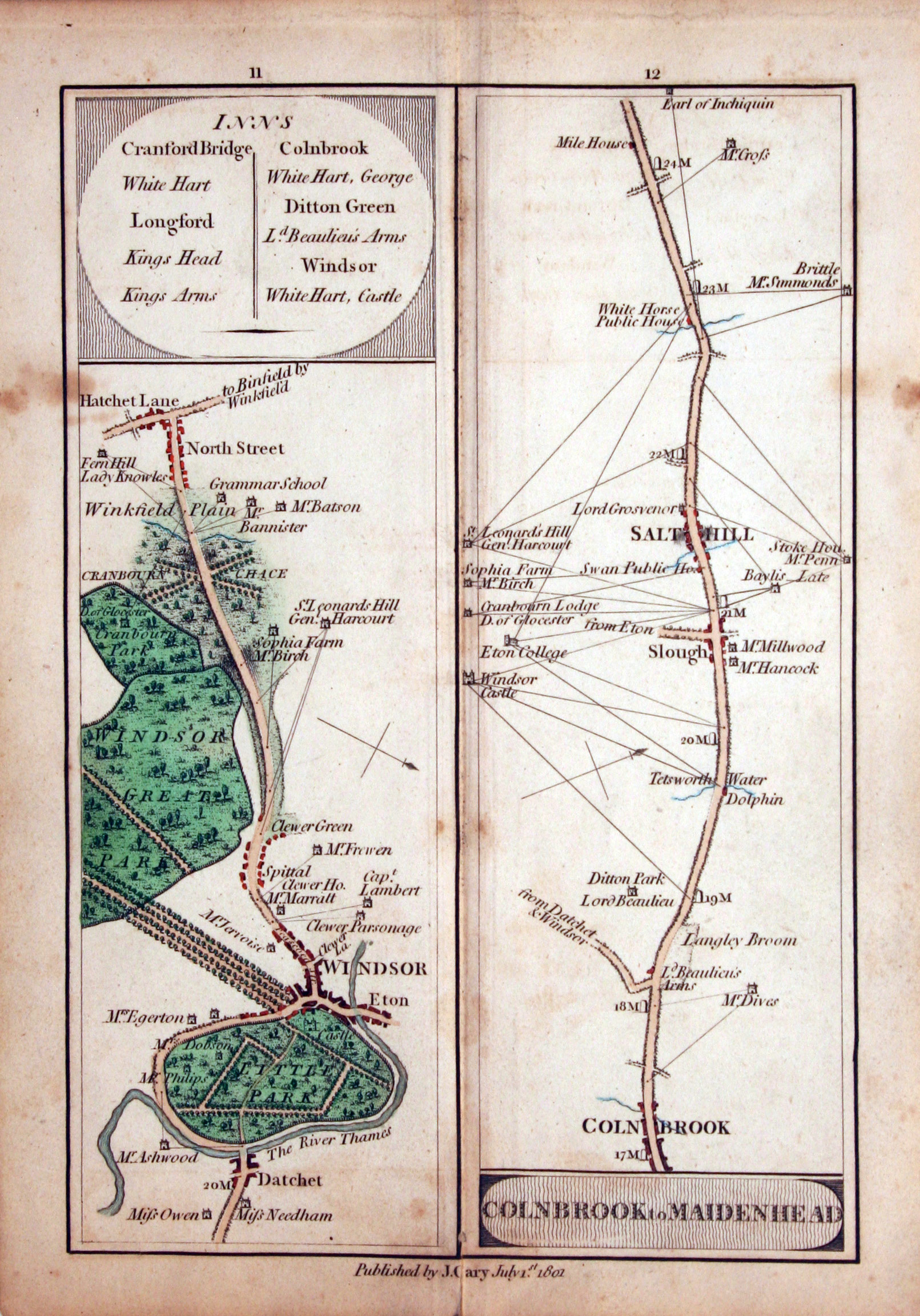
Plate 11/12

  • Houndslow to Windsor Road Map John Cary 1801

    Houndslow to Windsor Road Map John Cary 1801

Ref: 14106

11/12 HOUNSLOW TO WINDSOR - Part. Datchet, Windsor, North Street. COLNBROOK TO MAIDENHEAD - Part. Colnbrook, Salthill.

Small slit at the bottom of the centre fold

Price: 36.00

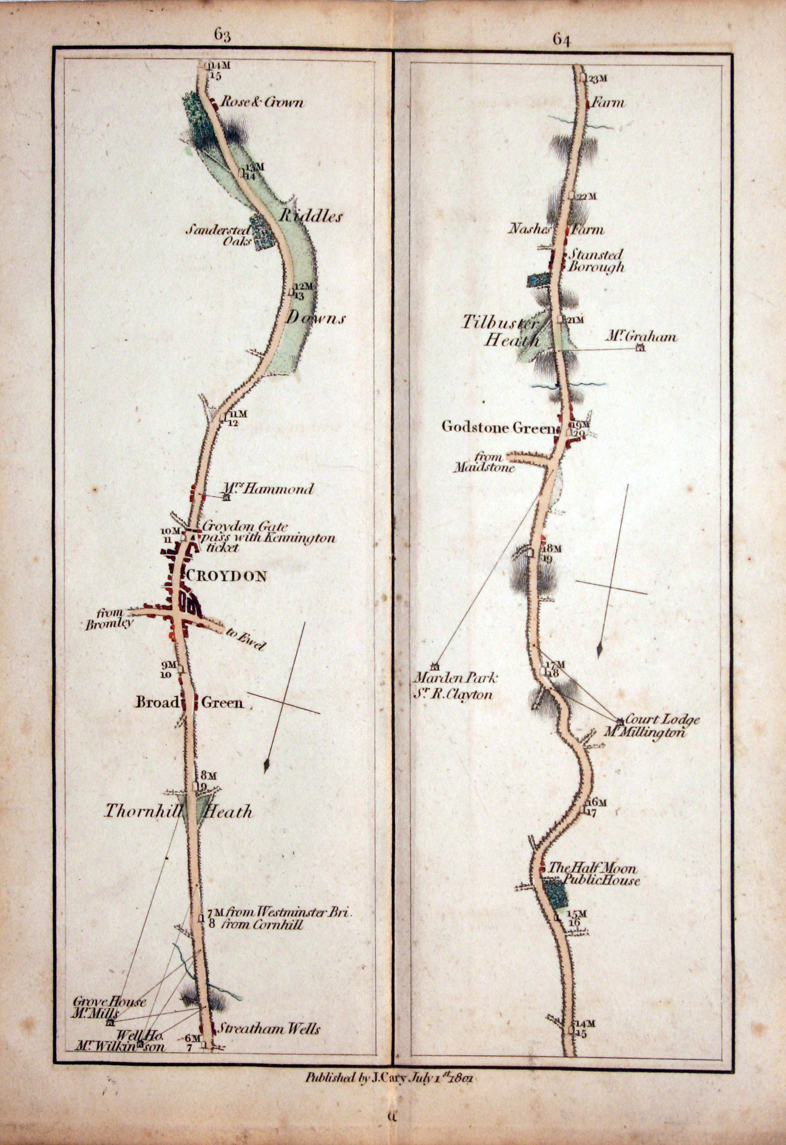
Plate 63/64

  • London to East Grinsted John Cary 1801

    London to East Grinsted John Cary 1801

Ref: 14129

63/64 LONDON TO EAST GRINSTED. Croydon, Godstone Green

Price: 36.00

  • Wiltshire, Thomas Kitchin, 1769

    Wiltshire, Thomas Kitchin, 1769

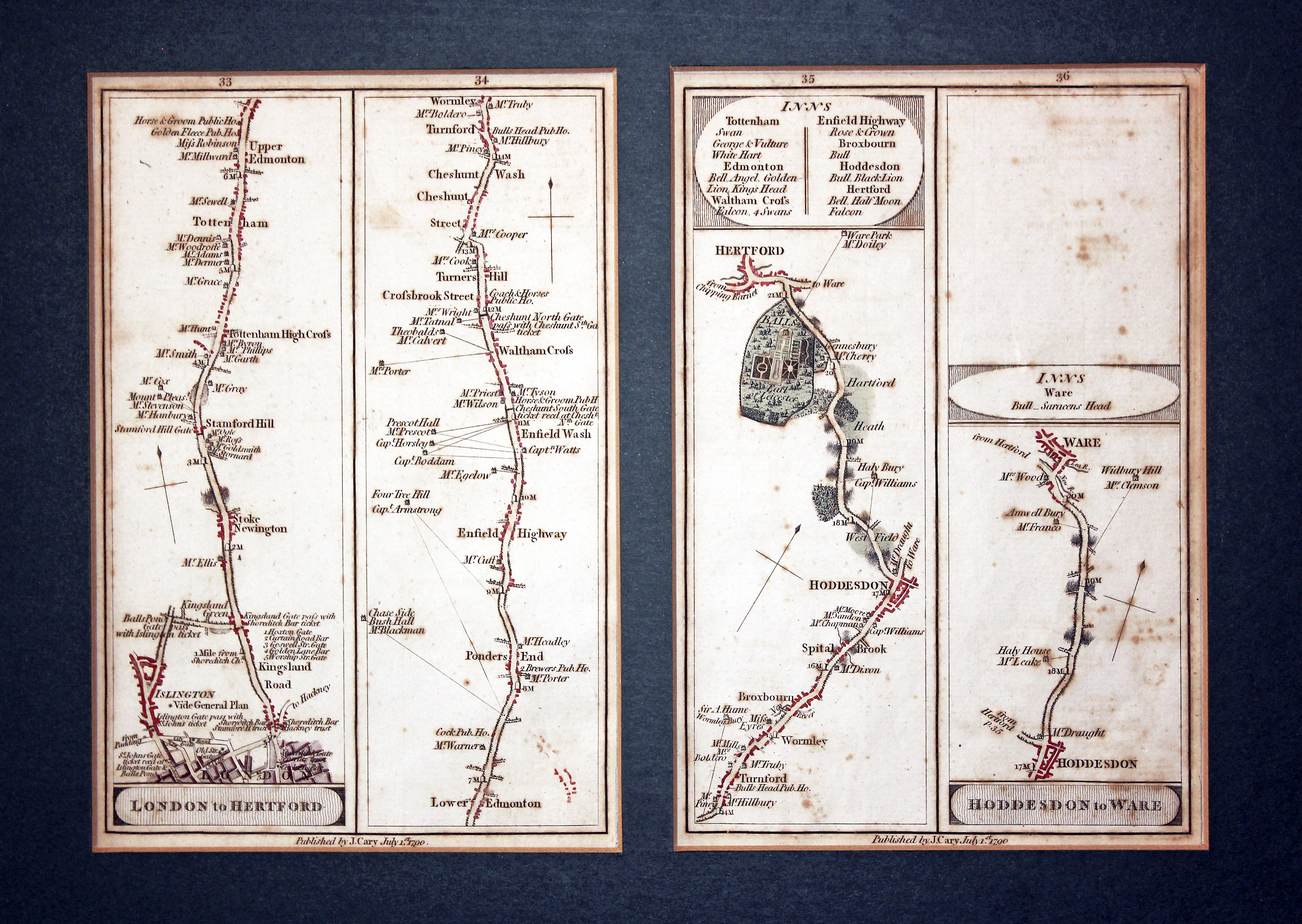
32249 Road Maps 33 - 36 by John Cary, 1790. Price: 70.00

LONDON TO HERTFORD

London, Stamford Hill, Upper Edmonton, Enfield, Wattham Cross, Turnford, Hoddesdon, Hertford. HODDESDON TO WARE. Hoddesdon, Ware. Two strip road maps showing plates 33, 34, 35 and 36. Each 5 x 7 1/2 inches. Early hand colouring. The two maps are presented in an inset dark green coloured mount with a 2 1/2 inch border which is still in good condition having been framed for many years. The maps have some scattered foxing but are in good condition.

RICHARD NICHOLSON
of CHESTER

Stoneydale
Pepper Street
Christleton
Chester
CH3 7AG

Telephone

01244 336004

International 44 1244 336004

Stacks Image 88

I have been buying and selling antique maps since the early 1960's during which time I had a gallery in Watergate Street, Chester for 30 years. I am now able to offer through my websites a personal service to map and print collectors.

Top
Antique Road Maps of High Roads from London, 1801

We use cookies to improve your browsing experience on our site, analyse site traffic and understand where our audience is coming from